Category Archives: Research

Flights at the ISARRA2016 conference

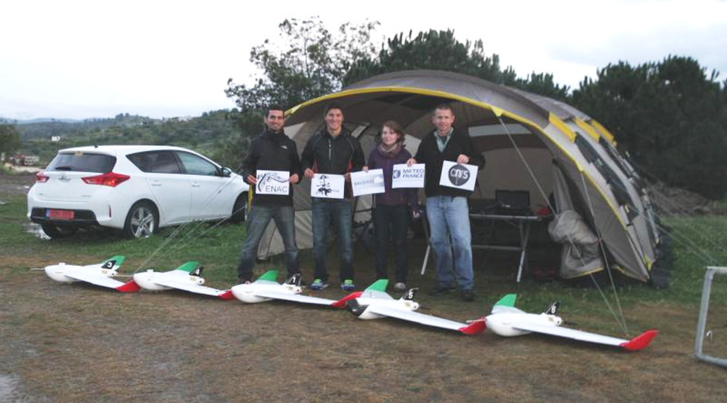
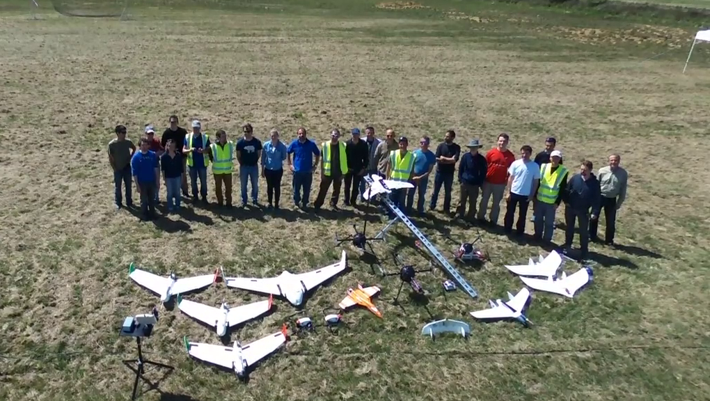
Last May, the ISARRA conference (International Society for Atmospheric Research using Remotely Piloted Aircraft) was held in Toulouse, France (http://www.meteo.fr/cic/meetings/2016/isarra/).

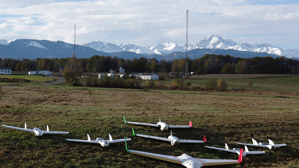
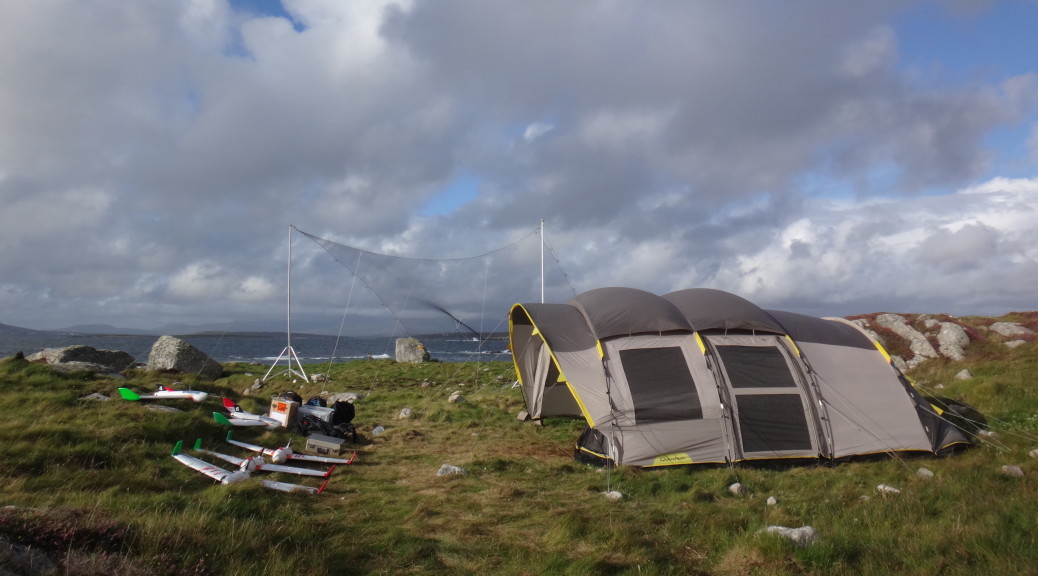
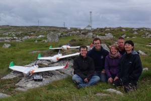
The week before the conference, a few teams of researchers gathered to share experiences and fly their drones at the Atmospheric Research Center of Lannemezan near the Pyrenees. Among them was some of the oldest users of Paparazzi: Martin Muller (http://blog.pfump.org), the team of Joachim Reuder from the Geophysical Institute of Bergen, the UAV Lab of ENAC and the French Meteorological Research Center who was hosting the event.

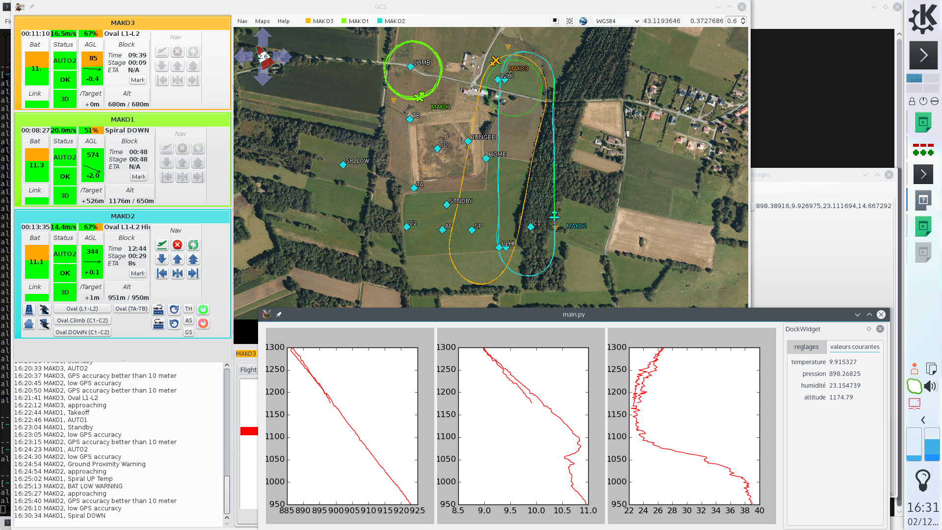
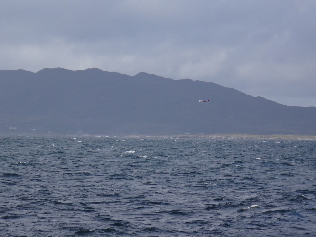
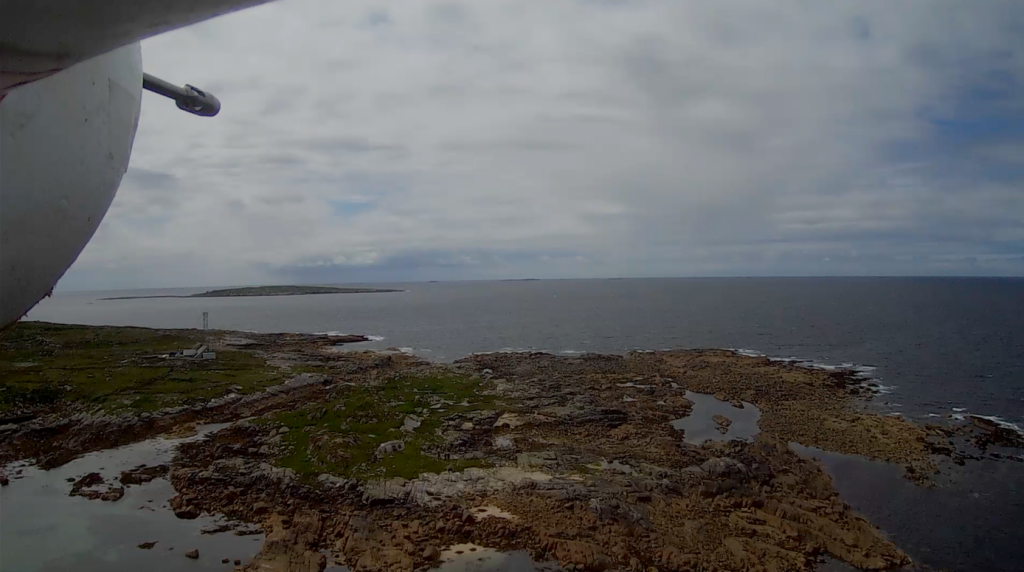
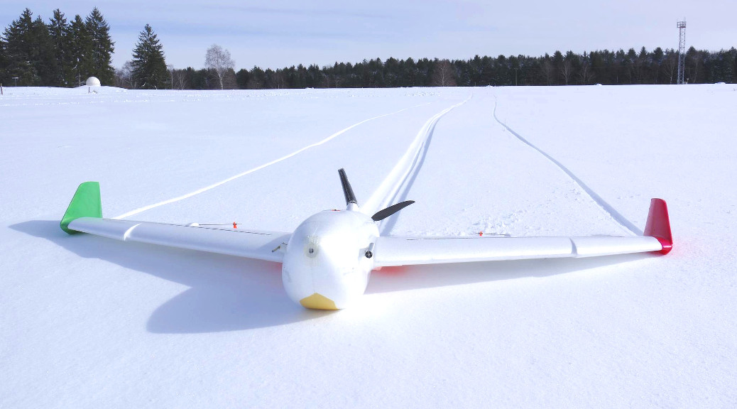
Many flights have been done, including for the ENAC lab, the first flight using ChibiOS v3 implementation and some autonomous catapult takeoff.


Facebooktwittergoogle_plusredditFacebooktwittergoogle_plusreddit
Facebooktwittergoogle_plusrssyoutubeFacebooktwittergoogle_plusrssyoutube

Lisa/S Nano Quadcopter featured on sUAS News

LadyLisa_Assembled_Kit_5_adjusted_1024x1024In the light of the recent FAA registration limits, the great guys at sUAS News wrote an article featuring the Paparazzi UAV powered Lisa/S nano Quadcopter. This platform was developed by 1BitSquared in collaboration with the TU-Delft MAV lab team, provides all the autonomous capabilities while being way below the FAA regulated limits for registration. The Lisa/S nano Quadcopter weighs only 39g while the FAA requires all aircraft above 250g to be registred.

Check out their article for more information.

Facebooktwittergoogle_plusredditFacebooktwittergoogle_plusreddit
Facebooktwittergoogle_plusrssyoutubeFacebooktwittergoogle_plusrssyoutube

Multi-UAV flights for simultaneous meteorological measurements

ENAC UAV Lab team and Meteo-France (CNRS-GAME and ENM) teams have spent several days at the Atmospheric Research Center of Lannemezan (in the south of France) in order to perform experiments for simultaneous meteorological measurements through multi-UAV flight.

This was part of a research project called VOLTIGE aimed at studying the formation of cloud and fog events. One of the planes is measuring the turbulence near the ground, a second plane is flying above the cloud or the fog with a radiation sensor and the last one is making a vertical profile of temperature, pressure and humidity up to 1500 meters AGL.GCS screenshot multi-uav

All the planes were controlled by Paparazzi UAV Apogee boards, with on-board logging on SD cards and navigation patterns triggered by sensors readings.

Facebooktwittergoogle_plusredditFacebooktwittergoogle_plusreddit
Facebooktwittergoogle_plusrssyoutubeFacebooktwittergoogle_plusrssyoutube

BACCHUS Meteorological Project

BACCHUS Research GroupResearchers from the GMEI/MNPCA have recently returned from a one month field measurement campaign at the weather
station of Mace Head in Ireland.
Their report was very positive with more than forty scientific flights, up to 3350m above sea level, some of them synchronized with a
meteorological satellite overpass, for the study of interactions between clouds and aerosols.
Several unmanned aircraft, equipped with the Paparazzi UAV
systems, have been used, carrying meteorological, aerosol, cloud and 3D wind sensors.
A bungee was used for taking-off, while a big net was needed in
order to recover the planes, since the ground was not suitable for traditional landings.
This campaign was part of the BACCHUS project (Impact of
Biogenic versus Anthropogenic emissions on Clouds and Climate: towards a Holistic UnderStanding).

DSC02173 copy

Mace_Head_aerial

Facebooktwittergoogle_plusredditFacebooktwittergoogle_plusreddit
Facebooktwittergoogle_plusrssyoutubeFacebooktwittergoogle_plusrssyoutube

Paparazzi UAV Videos 2004-2010

A few days ago ENAC UAV Lab uploaded their Paparazzi UAV video collection from 2004-2010. If you are interested in some Open-Source UAV history you should take a look at them.

It is exciting to see how many things Paparazzi UAV could already do 5 to 10 years ago, as well as how far things have improved and evolved since then.

One of the highlights is a multi UAV flight at IMAV2006. This is 9 years ago. It is great to see how relaxed the safety pilots are. 🙂

Another highlight is the Paparazzi UAV Ground Control Station (GCS). It definitely has many of the elements of how the GCS looks today but it definitely changed and improved over the years.

Facebooktwittergoogle_plusredditFacebooktwittergoogle_plusreddit
Facebooktwittergoogle_plusrssyoutubeFacebooktwittergoogle_plusrssyoutube

Paparazzi at the National Center for Meteorological Research

Cyprus_X6_fleetThe National Center for Meteorological Research (CNRM-GAME, Toulouse, France) conducted an airborne experiment in Cyprus in March 2015 as part of the BACCHUS project. The main goal of CNRM‘s contribution is to complement the ground-based observations of aerosol and cloud condensation nuclei with airborne measurements to characterize the vertical distribution of aerosol, radiative fluxes, 3D wind vectors and meteorological state parameters. As payloads were limited to 500g (and total weight < 2.5kg), multiple RPAS (remotely piloted aircraft systems) were instrumented for a specific scientific focus. The Paparazzi system was used to navigate the RPAS. During the campaign, airborne measurements were taken over 4 weeks (5 March to 2 April, 2015) with 52 research flights and 38 hours of flight time. Vertical profile were regularly sampled up to 2100 m.asl (limited by authorized flight ceiling) and often observed the layers of dust originating from the Arabian Peninsula and the Sahara Desert. RPAS profiles generally show a well-mixed boundary layer and compare well with ground-based LIDAR observations. Flights below and within clouds were also coordinated with satellite overpasses to perform ‘top-down’ closure of cloud micro-physical properties.

Facebooktwittergoogle_plusredditFacebooktwittergoogle_plusreddit
Facebooktwittergoogle_plusrssyoutubeFacebooktwittergoogle_plusrssyoutube

ENAC Flying Paparazzi Aircraft at the Atmospheric Research Center of Lannemezan

X6_meteo_franceThe ENAC team has been flying several aircraft (X6-Skywalker, Easystar, Funjet) at the Atmospheric Research Center of Lannemezan, close to the Pyrenees in the south of France. The goal was to prepare several meteorological planes for research studies held by Meteo France that will be held next month in Cyprus. Weather conditions were pretty harsh some times, with snow and icy fog, but also provided some really nice pictures, and of course interesting flights up to 1400m AGL with meteorological instruments.

See this video of the previous campaign:

Or this other video of the first tests of automatic bungee takeoff for the heavier planes (up to 2.5kg):

Facebooktwittergoogle_plusredditFacebooktwittergoogle_plusreddit
Facebooktwittergoogle_plusrssyoutubeFacebooktwittergoogle_plusrssyoutube